
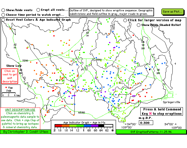
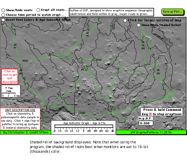
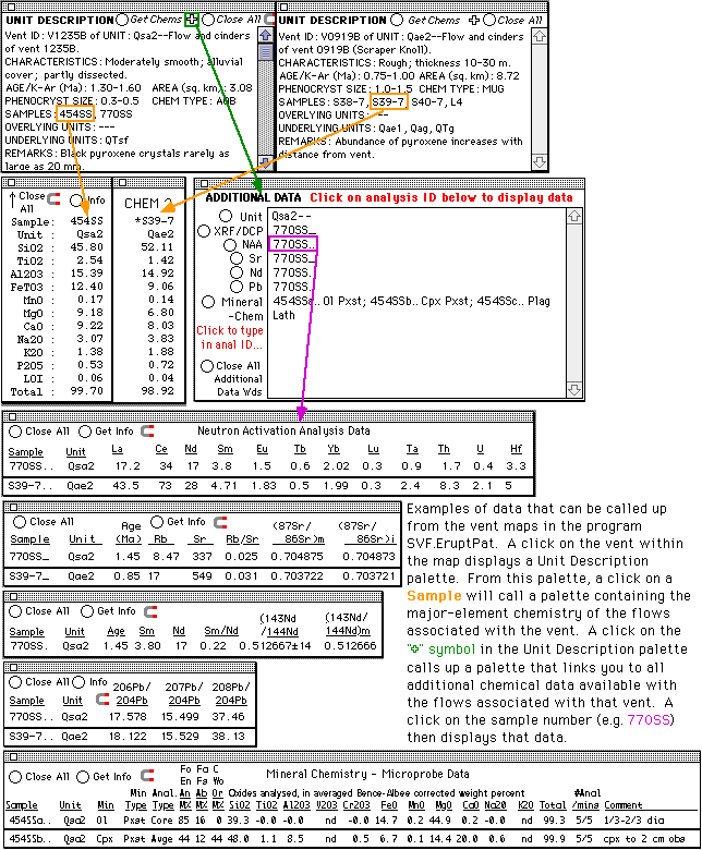
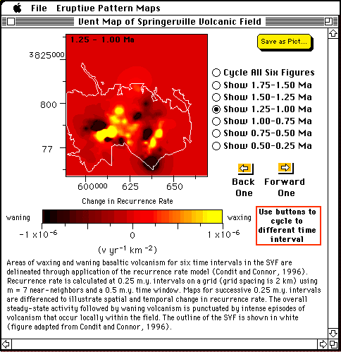
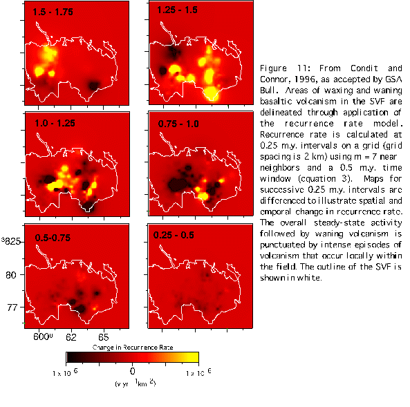
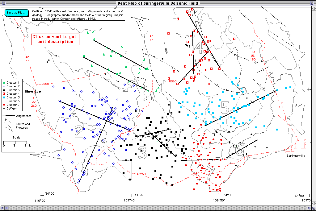
This program gives you the capability to examine the eruption patterns of Springerville volcanic field, as displayed in various vent maps of the field. The Springerville field is one of several a late Cenozoic basaltic fields located on the southern margin of the Colorado Plateau, in east-central Arizona. The program is a SuperCard stand-alone project (downlaod project) that takes up 3.4 MB of disk space, and requires a Mac with 5.3 MB of free RAM (6.3 preferred) and a color monitor to run. A demonstration version of the includes the following features: A Welcome Screen which is an oblique airphoto showing part of the field. Menus direct you to four different maps, the first two give you a choice of either a small or large map of the field (depending on your monitor size and available RAM). On these maps you can click a button and watch which vents are active sequentially through time, or choose to watch which vents are active during different time periods, and give vents of different intervals distinct colors. On these maps, you can also display a shaded relief map of the field. Vents in these maps can be clicked on to call-up unit descriptions, and the major, trace, mineral and isotopic chemistry from flows of each. From the menu you can also call up another maps, which is an animated sequence showing the waxing and waning of volcanism for six different time periods in the field (a single-page format of this figure is also included). The last map of the project shows the tectonic features and clusters of vents within the field; as with the first two maps, you can click on vents to obtain data. Additional feature of the program include the ability to save vent maps to disk, and a complete reference list of papers that contributed data to this program.
|
|
Last revised 03 December 96-- ccondit@geo.umass.edu |
|